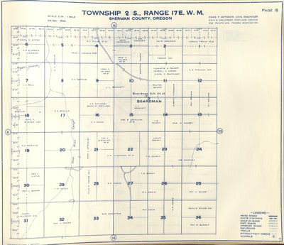
Metsker Map of Searcy Property
Dublin Core
Title
Metsker Map of Searcy Property
Subject
Searcy Property 1934
Description
Map of property owners for T2S, R17E, Sherman County Oregon 1934
Creator
Metsker Maps
Date
1934
Rights
OSU Special Collections and Archives Research Center
Format
JPG
Identifier
Metsker_T2S_R17E_1934
Coverage
1934
Document Item Type Metadata
Original Format
paper
Citation
Metsker Maps, “Metsker Map of Searcy Property,” Special Collections & Archives Research Center, accessed May 3, 2025, http://scarc.library.oregonstate.edu/omeka/items/show/29556.

